01
You Reach Out
Call, text, or send a quick quote request. We'll talk through field location, the product or rate you need, and your timeline.
Working with an agronomist or retailer? We can pull the prescription directly from them.
Designed to be fast, clean, and fully documented — every step.
Call, text, or send a quick quote request. We'll talk through field location, the product or rate you need, and your timeline.
Working with an agronomist or retailer? We can pull the prescription directly from them.
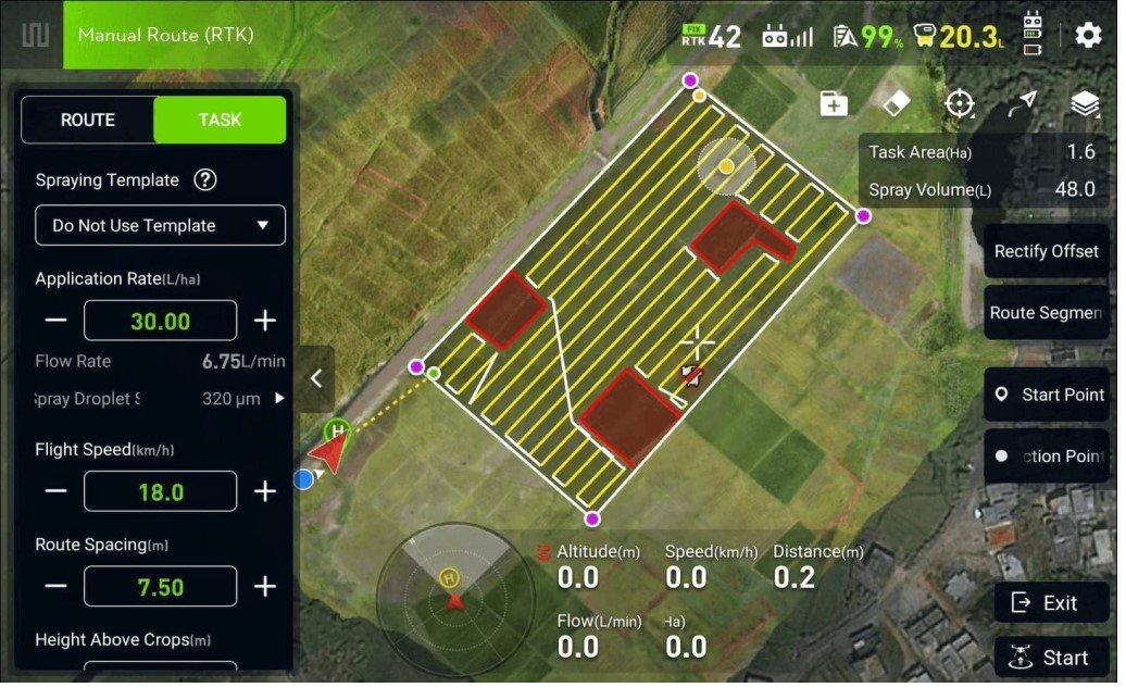
We gather everything we need to apply correctly — field boundaries, chemical or seed product, target rate, and any obstacles or sensitive areas.
If a prescription map already exists, we use it. If not, we'll build one for you.
Field is mapped ahead of time. The job is scheduled around weather, wind, and your operation — so when conditions are right, we're ready to go.
You get a confirmation with the scheduled window — no guessing.
The drone flies the field autonomously using the preloaded prescription. Chemical mixes on the trailer, batteries rotate, and the operation keeps moving.
RTK-guided. Even coverage. No driving on the crop.
Same-day report with everything you need — coverage map, acres applied, products and rates, weather conditions during the flight, and your invoice.
No follow-up phone calls. No paperwork chasing.
Visual of every acre flown — boundaries, swath, and any skipped zones documented.
Exact acreage flown — what you're billed for, no rounding.
Product, target rate, actual rate. Documented for records and audits.
Wind speed, temperature, and humidity logged during application.